Wildfires From Space: Part II — The SCU Lightning Complex near San Jose
Posted on Mon 28 September 2020 in wildfires
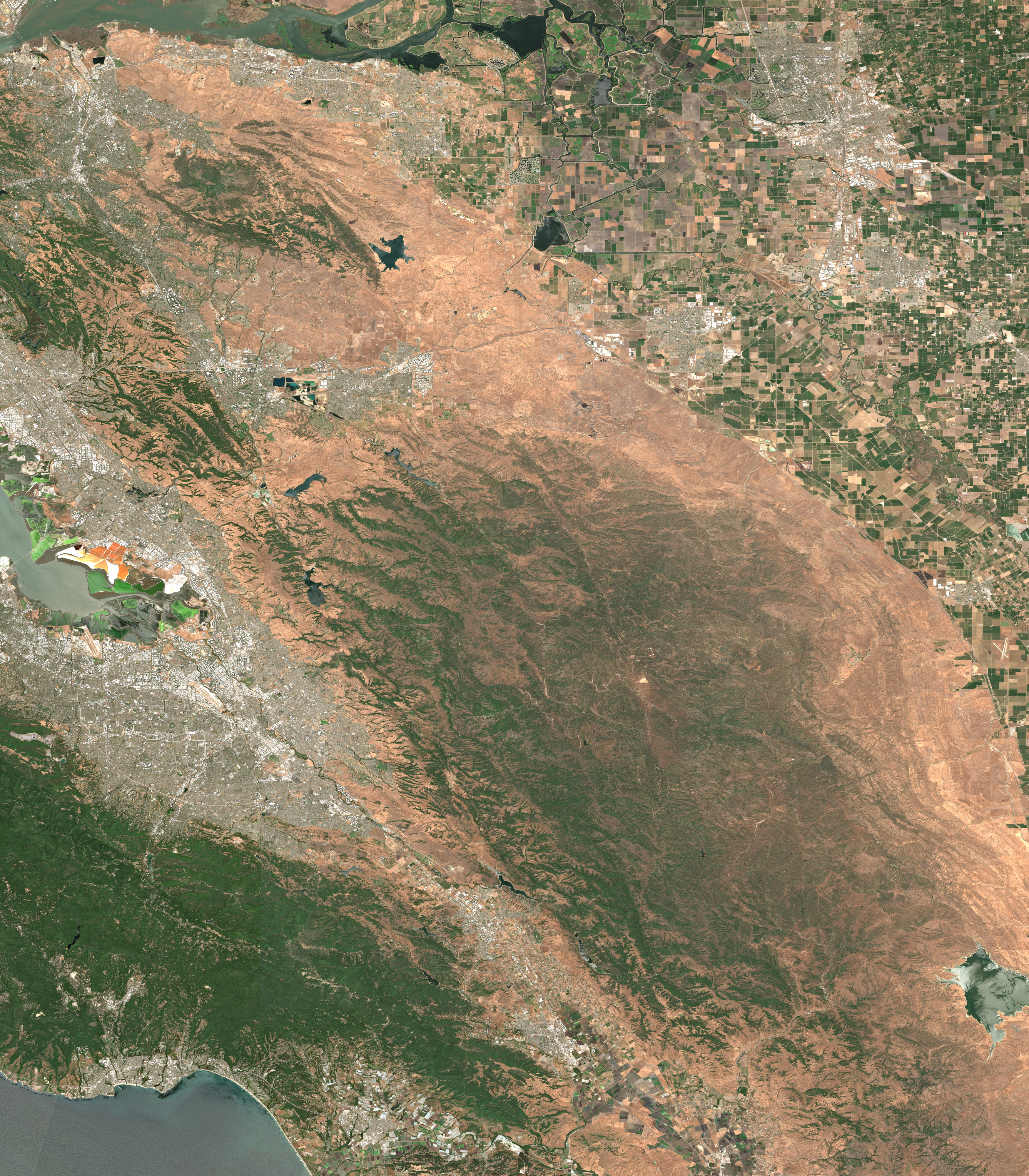
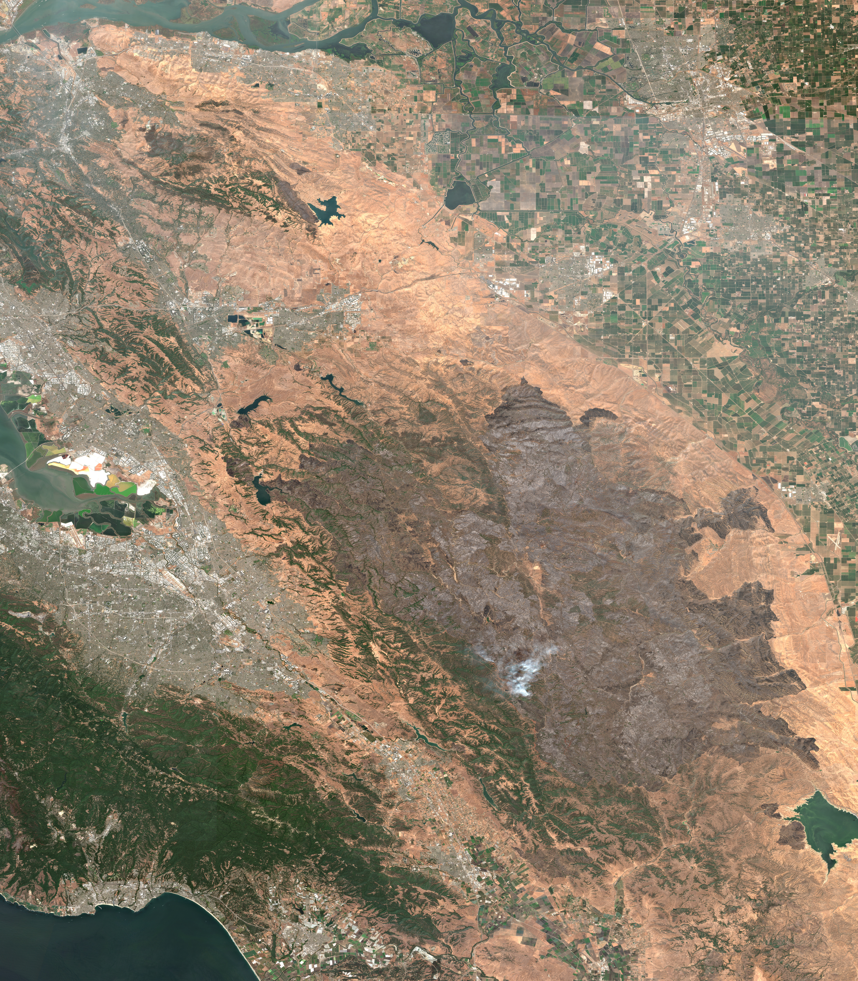
The SCU Lightning Complex east of San Jose is one of several significant wild fires which affected the US West Coast in recent weeks. The fire started on August 16, 2020, and burned nearly 400,000 acres over a period of several weeks.
To visualize the impact of the fire, I mosaicked two recent true-color images taken from space by ESA's Sentinel-2 satellite. You can download high-resolution versions of these images here and here.
This is the Bay Area east of San Jose in California, seen from space before & after the recent #wildfires.
— Geert Barentsen (@GeertHub) September 28, 2020
Unprecedented fires have turned 300,000 football fields of nature into a giant brown scar. The images are 70 miles wide!
⬇️ Jun 3, 2020 vs Sep 6, 2020 ↘️ pic.twitter.com/mFODtGrZOA
For scale: here is how the burn area compares to the rest of the Bay Area.
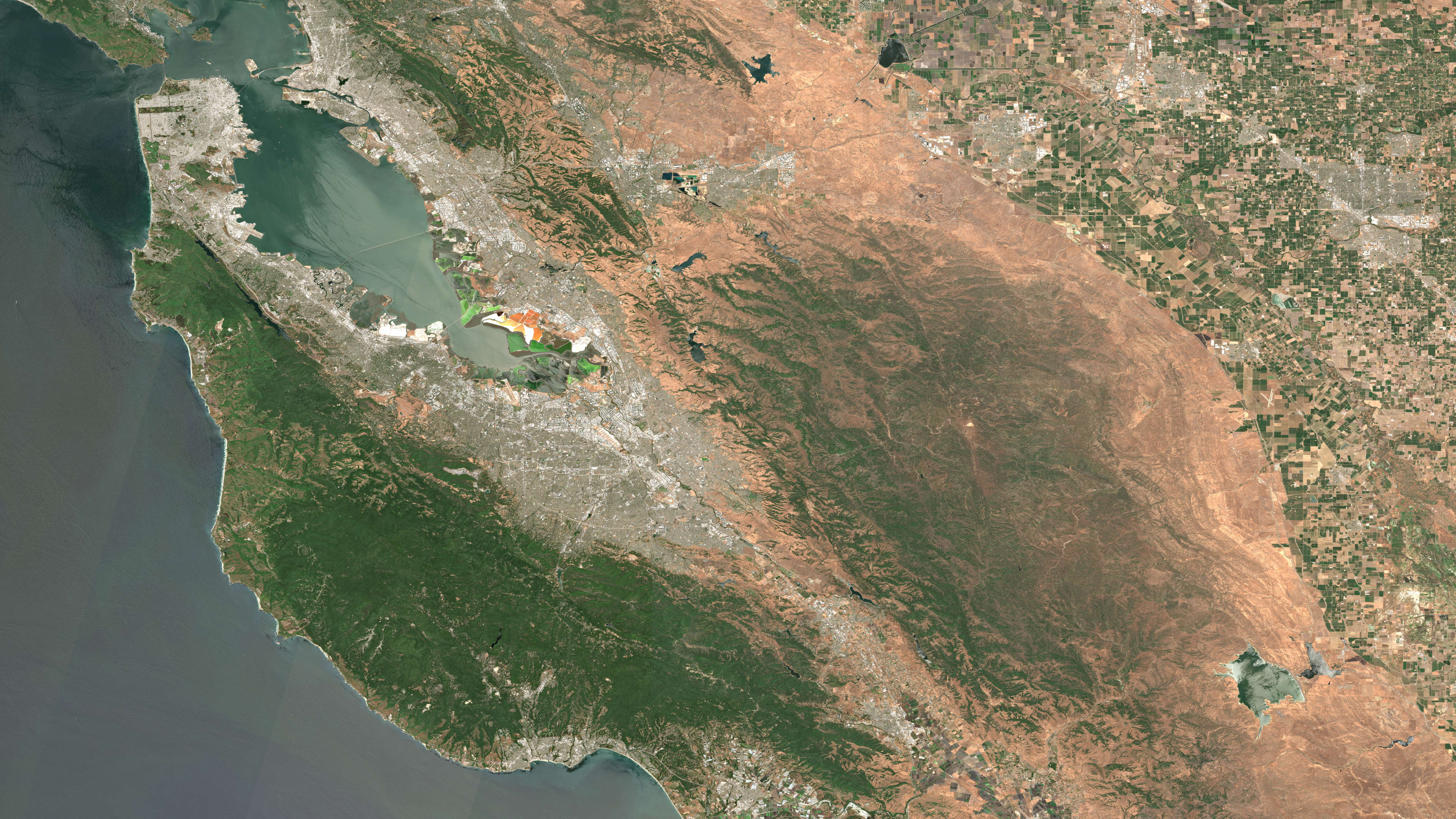
San Francisco Bay Area seen from space on June 3, 2020.
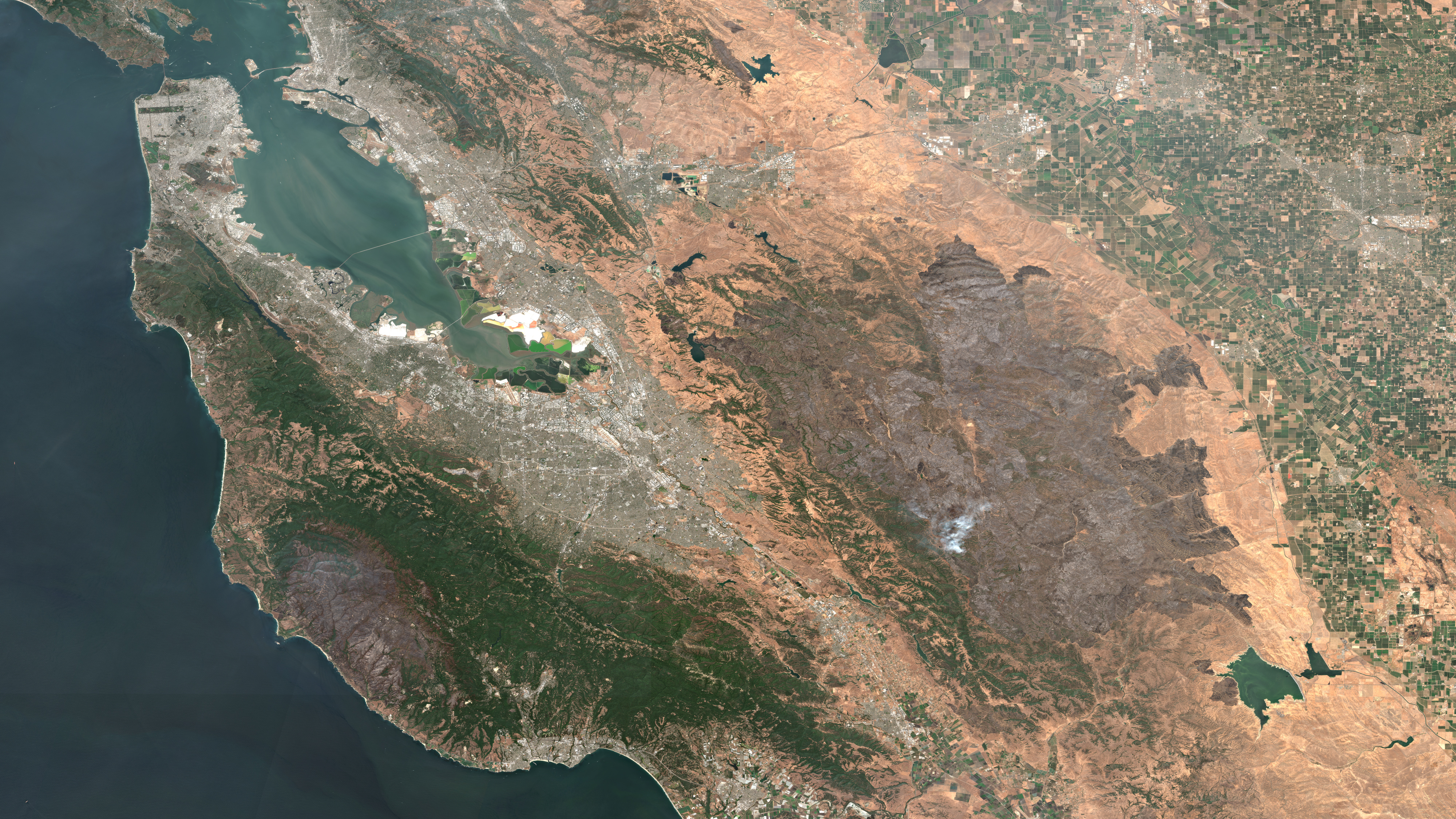
San Francisco Bay Area seen from space on September 6, 2020.
Image details
Both images were taken by ESA's Copernicus Sentinel-2 satellite and turned into cloud-free mosaics using Google's fabulous Earth Engine platform. You can recreate the image for September 6th using the following Earth Engine script:
1 2 3 4 5 6 7 8 9 10 11 12 13 14 | var mosaic = ee.ImageCollection('COPERNICUS/S2_SR') .filterBounds(geometry) .filterDate('2020-09-05', '2020-09-07') .sort('CLOUDY_PIXEL_PERCENTAGE', false) .mosaic() .clip(geometry); var params = {bands: ['TCI_R', 'TCI_G', 'TCI_B'], min: 0.0, max: [250, 250, 250], gamma: [1.45, 1.45, 1.45] }; Map.addLayer(mosaic, params, 'mosaic'); |