Wildfires From Space: Part III — The Bobcat Fire near Los Angeles
Posted on Thu 15 October 2020 in wildfires
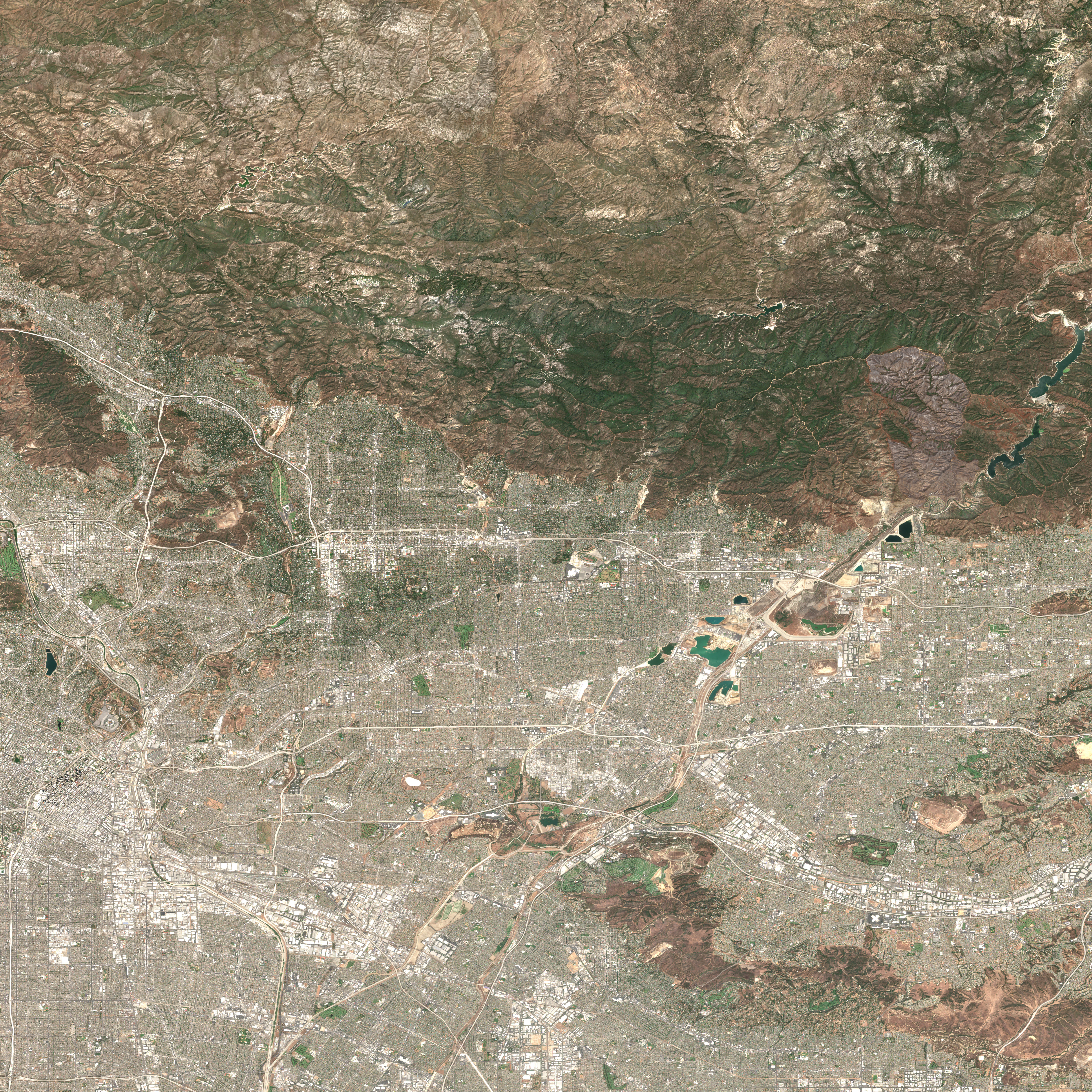
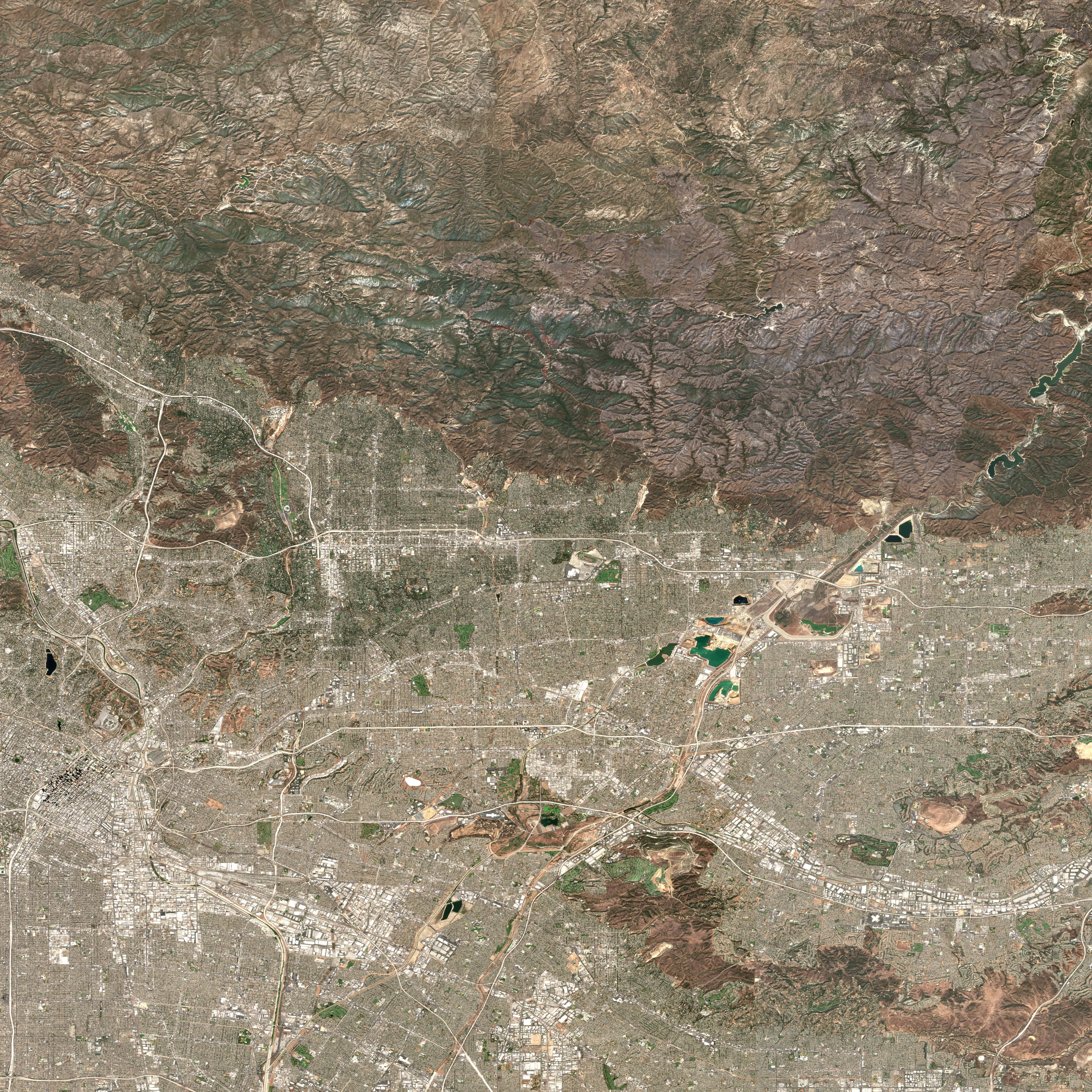
The Bobcat Fire just north of Los Angeles one of the numerous wild fires which affected the US West Coast in recent weeks. The fire started on September 6th, 2020, and burned more than 110,000 acres.
To visualize the impact of the fire, I mosaicked two recent true-color images taken from space by ESA's Sentinel-2 satellite. You can download high-resolution versions of these images here and here.
This is Los Angeles, seen from space before & after the start of the #BobcatFire. 🔥
— Geert Barentsen (@GeertHub) October 15, 2020
Can you spot the giant brown fire scar in the hills north of the city?
⬇️ Aug 31 vs Sep 30 ↘️ pic.twitter.com/JsiLkEe4B5
Image details
Both images were taken by ESA's Copernicus Sentinel-2 satellite and turned into cloud-free mosaics using Google's Earth Engine platform. You can recreate the second image using the following Earth Engine script:
1 2 3 4 5 6 7 8 9 10 11 12 13 14 | var mosaic = ee.ImageCollection('COPERNICUS/S2_SR') .filterBounds(geometry) .filterDate('2020-09-30', '2020-10-01') .sort('CLOUDY_PIXEL_PERCENTAGE', false) .mosaic() .clip(geometry); var params = {bands: ['TCI_R', 'TCI_G', 'TCI_B'], min: 0.0, max: [250, 250, 250], gamma: [1.45, 1.45, 1.45] }; Map.addLayer(mosaic, params, 'mosaic'); |