Footprint of the IPHAS Galactic Plane survey
Posted on Mon 22 October 2012 in astronomy
As part of my post-doc at the University of Hertfordshire, I'm helping to calibrate, release and exploit data obtained by the INT Photometric H-Alpha Survey (IPHAS). This is a 1800 deg2 optical survey of the Northern Galactic Plane, carried out in the narrow-band Hα and broad-band Sloan r'/i' filters. I'll be talking more about the survey in future posts, but as a warm-up I produced this plot of the survey's 15270 telescope pointings:
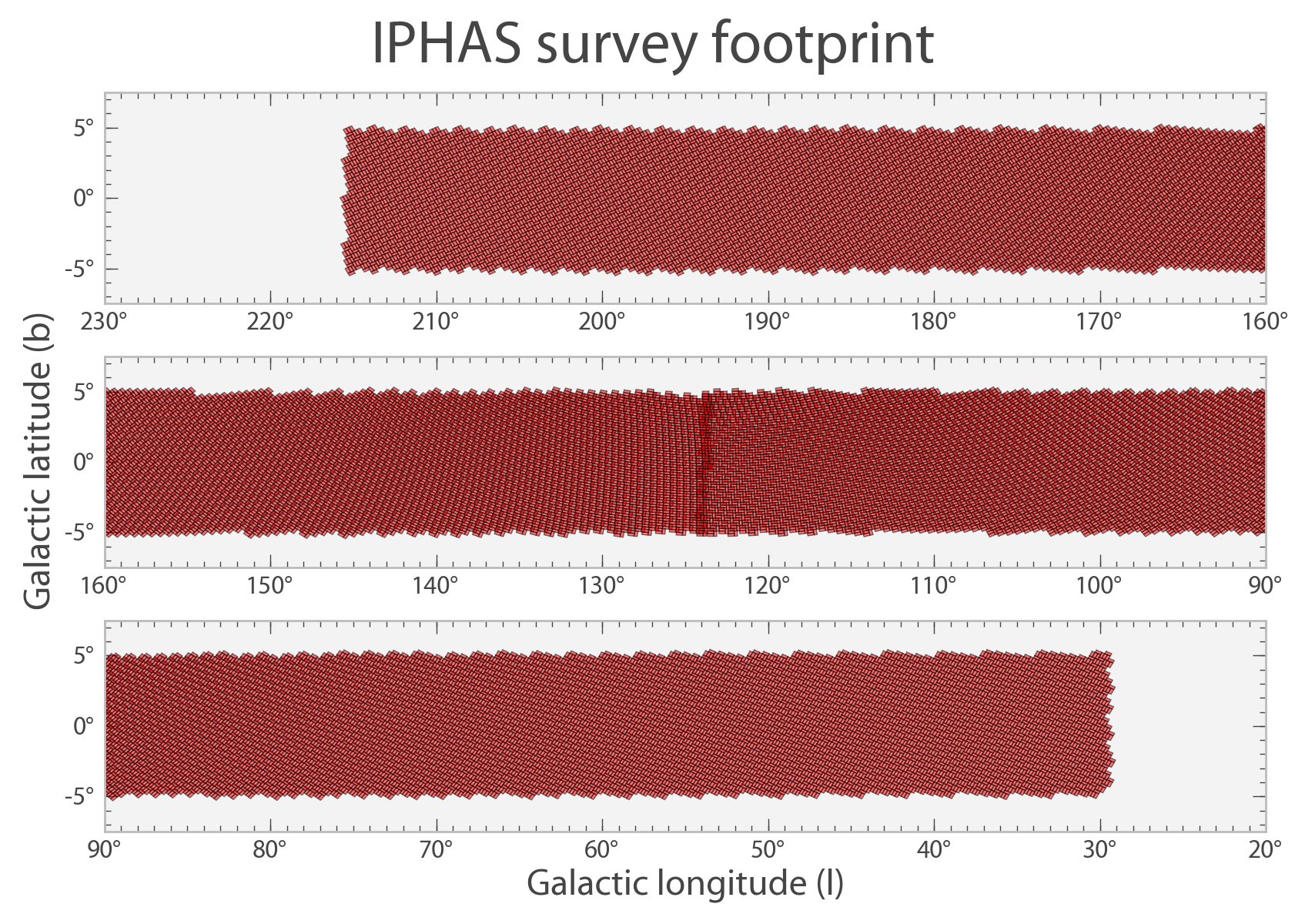
Footprint of the IPHAS survey.
Let me explain this footprint briefly. The survey uses the Wide-Field Camera (WFC) at the 2.5-meter Isaac Newton Telescope (INT) in La Palma. This camera consists of four thinned 2048 × 4096 pixel CCDs arranged in an L shape like this:
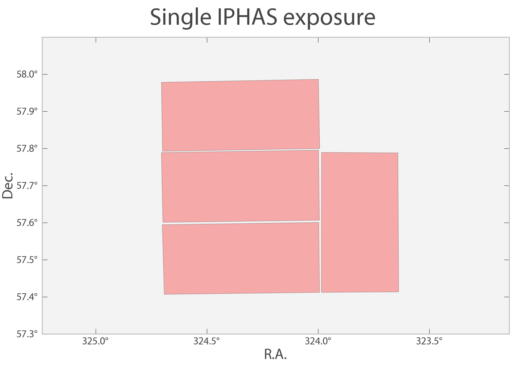
Footprint of a single IPHAS (WFC) exposure.
The four CCDs provide a combined field of view of 0.3 deg2, hence the minimum number of pointings required to cover the 1800 deg2 survey area is 6000. However, the survey was designed to provide a 5% overlap between adjacent fields to enable data quality and calibration checks. As a result, the footprint contains a total of 7635 fields which partially overlap.
Furthermore, each field was paired with a so-called offset field at 5 arcmin West and South, to cover the narrow gaps between the CCD chips. This explains the final number of 7635 x 2 = 15 270 pointings. When their footprints are plotted using 30% opacity, a complicated sky coverage pattern emerges. Whilst the majority of the sky is covered twice, there are overlap areas which are covered three or four times (dark patches) and narrow bands between CCD chips which are covered only once (brighter strips):
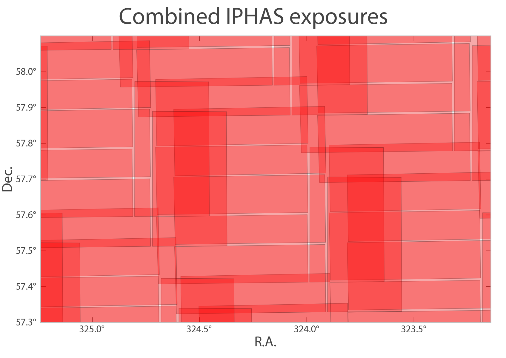
IPHAS footprints plotted with 30% opacity. The darkest overlap areas are covered four times, while the the narrow bands between CCD chips are exposed only once.
A tricky question which results from this coverage pattern is: how should the final source catalogue be generated? Some objects are observed four times, sometimes many years apart, whilst others are only observed once. Should multiple exposures of a single object be averaged, or should only the best exposure be adopted in the source catalogue? Such tricky decisions have to be made for all surveys because telescopes don't make catalogues (see Hogg & Lang 2010.)
An obvious solution is to release both a catalogue of individual detections on one hand, and a catalogue of averaged source properties on the other hand (there has already been a fair bit of thinking and discussion in this direction within the IPHAS team!)
Such catalogue releases should preferably be supplemented by scriptable access to the calibrated pixel data, through image cut-outs, to enable users to re-measure properties or fit models to the actual pixel data. Is there a standard VO protocol for this? There is the Simple Image Access protocol, but is not quite designed for cut-outs!
How do you think surveys with a complicated sky coverage pattern should generate their catalogues and make data available?